


A new paper published in the peer review magazine Oceanography shows robotic ocean observing platforms can improve intensity forecasts for hurricanes and tropical storms and should be supported as a crucial component of the ocean infrastructure designed to protect the lives of coastal residents and mitigate the economic impact from storms.
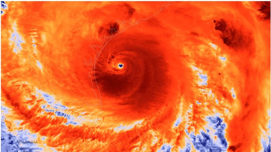
In the U.S., hurricanes have caused more than $1 trillion in losses since 1980, and while the landfall forecasts that drive evacuation orders and guide coastal preparations ahead of storms have been steadily improving, storm strength forecasting has lagged. Storm intensity is influenced by many factors, including atmospheric circulation, internal storm dynamics and air-sea interactions, as well as boundary currents — for instance, the Loop Current in the Gulf of Mexico — and even seafloor topography.
While some existing ocean observing tools provide data useful for numerical storm modeling, they are not responsive enough to fill all the data gaps, especially in the air-sea interface — where the ocean and atmosphere exchange heat and energy — and upper ocean dynamics, which are critical for forecasting storm strength. Between 2018 and 2021, underwater gliders were deployed more than 280 times and spent 13,000 days at sea in the open Atlantic Ocean, the Caribbean Sea, the Gulf of Mexico and off the U.S. East Coast during hurricane seasons to test whether they could help fill the data gaps.

Glider tracks from the 2018 (orange), 2019 (purple), 2020 (yellow), and 2021* (blue) hurricane seasons (May to November) generated with data from the Integrated Ocean Observing System Glider Data Assembly Center, with an overlay of tropical cyclone tracks (black dots) from the International Best Track Archive for Climate Stewardship (IBTrACS). The table in the upper left indicates the yearly breakdown of glider deployments, glider days at sea, and collected profiles. (*2021 data were extracted on Sept. 17, 2021, prior to the completion of the Atlantic hurricane season.)
Underwater gliders are autonomous underwater robots that collect ocean data in remote locations and at depth and can be programmed and piloted remotely to conduct specific missions. These gliders are equipped to communicate with satellites, allowing them to transmit ocean data to modelers and forecasters in real time or near-real time. In 2021, Saildrones — wind and solar-powered vehicles that travel along the ocean’s surface to gather data — were also employed. They also communicate via satellite in real time or near-real time.
Both types of robots can operate and gather data in hazardous conditions where sending crewed ships would put human lives at risk. And, given their ability to communicate data quickly, information can be utilized for storm forecasting in near-real time — even while storms are approaching coastal populations.
For instance, during the 2021 season, the National Oceanic and Atmospheric Administration (NOAA) supported the first-time deployment and operation of five extreme weather Saildrones strategically located in the western tropical Atlantic, the Caribbean and East Coast. They continuously measured properties in the near-surface atmosphere and ocean and transmitted one-minute averaged data to the data centers in real time for assimilation into forecast models and for other public use.
In the paper, “Uncrewed Ocean Gliders and Saildrones Support Hurricane Forecasting and Research,” authors from more than a dozen governmental, nongovernmental and academic institutions involved in deploying these platforms during the 2021 hurricane season detailed how gliders have improved intensity forecasting and, further, how adding Saildrones operating in close proximity improved intensity forecasting even further.
“One of the main objectives during the 2021 Atlantic hurricane season was to obtain measurements of the upper ocean and air-sea coupling within a hurricane from collocated platforms at the same time,” said the study’s lead author, Dr. Travis N. Miles, Assistant Professor in the Rutgers University Center for Ocean Observing Leadership. “These data can help us understand how upper ocean features and the overlying atmosphere co-evolve during hurricanes. This is particularly important with storms like Ida that rapidly intensified over the dynamic coastal ocean before making landfall. Direct assimilation of these data into models, and new model development based on research findings will lead to improved modeling systems and ultimately better intensity forecasts”
The study also calls for future deployments to combine simultaneous measurements to continue to improve hurricane modeling and forecasting.
“In the ocean observing community, we know that the tools and technologies we bring to bear to help forecast the strength and movement of these storms saves lives and that our predictions have greatly improved over time,” says Dr. Barbara Kirkpatrick, study co-author and Senior Advisor from the Gulf of Mexico Coastal Ocean Observing Organization (GCOOS), which hosts and shares ocean observing data from gliders and other instruments. “We also know that having more ocean observing assets in place could only make things safer for all coastal communities — in the Gulf of Mexico and beyond. At GCOOS, we continue to advocate for funding to support these tools.”
Study Citation
Miles, T.N., D. Zhang, G.R. Foltz, J. Zhang, C. Meinig, F. Bringas, J. Triñanes, M. Le Hénaff, M.F. Aristizabal Vargas, S. Coakley, C.R. Edwards, D. Gong, R.E. Todd, M.J. Oliver, W.D. Wilson, K. Whilden, B. Kirkpatrick, P. Chardon-Maldonado, J.M. Morell, D. Hernandez, G. Kuska, C.D. Stienbarger, K. Bailey, C. Zhang, S.M. Glenn, and G.J. Goni. 2021. Uncrewed ocean gliders and saildrones support hurricane forecasting and research. Pp. 78–81 in Frontiers in Ocean Observing: Documenting Ecosystems, Understanding Environmental Changes, Forecasting Hazards. E.S. Kappel, S.K. Juniper, S. Seeyave, E. Smith, and M. Visbeck, eds, A Supplement to Oceanography 34(4), https://doi.org/10.5670/oceanog.2021.supplement.02-28.
Authors and Affiliations
Travis N. Miles, Rutgers, The State University of New Jersey, Department of Marine and Coastal Sciences, | Dongxiao Zhang, NOAA Pacific Marine Environmental Laboratory, and Cooperative Institute for Climate, Ocean, and Ecosystem Studies, University of Washington | Gregory R. Foltz, NOAA Atlantic Oceanographic and Meteorological Laboratory | Jun A. Zhang, Cooperative Institute for Marine and Atmospheric Studies, University of Miami | Christian Meinig, NOAA Pacific Marine Environmental Laboratory | Francis Bringas, NOAA Atlantic Oceanographic and Meteorological Laboratory | Joaquin Triñanes, Department of Electronics and Computer Science, Universidade de Santiago de Compostela, Spain | Matthieu Le Hénaff, Cooperative Institute for Marine and Atmospheric Studies, University of Miami and NOAA Atlantic Oceanographic and Meteorological Laboratory | Maria F. Aristizabal Vargas, IM Systems Group at NOAA Environmental Modeling Center | Sam Coakley, Rutgers, The State University of New Jersey, Department of Marine and Coastal Sciences | Catherine R. Edwards, Skidaway Institute of Oceanography, University of Georgia | Donglai Gong, Virginia Institute of Marine Science, College of William & Mary | Robert E. Todd, Woods Hole Oceanographic Institution | Matthew J. Oliver, School of Marine Science and Policy, University of Delaware | W. Douglas Wilson, Ocean and Coastal Observing, Virgin Islands | Kerri Whilden, Gulf of Mexico Coastal Ocean Observing System Regional Association and Texas A&M University | Barbara Kirkpatrick, Gulf of Mexico Coastal Ocean Observing System Regional Association and Texas A&M University | Patricia Chardon-Maldonado, Caribbean Coastal Ocean Observing System, Puerto Rico | Julio M. Morell, Caribbean Coastal Ocean Observing System, Puerto Rico | Debra Hernandez, Southeast Coastal Ocean Observing Regional Association | Gerhard Kuska, Mid Atlantic Regional Association Coastal Ocean Observing System | Cheyenne D. Stienbarger, NOAA Global Ocean Monitoring and Observing Program | Kathleen Bailey, NOAA US Integrated Ocean Observing System Office | Chidong Zhang, NOAA Pacific Marine Environmental Laboratory | Scott M. Glenn, Rutgers, The State University of New Jersey, Department of Marine and Coastal Sciences | Gustavo J. Goni, NOAA Atlantic Oceanographic and Meteorological Laboratory


