Sensors and Platforms
Buoys and Sample Transects

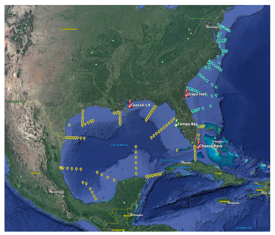
NOAA-funded buoys (in red) in Gray’s Reef, Cheeka Rocks and Southern Louisiana; non-NOAA funded buoy (in green) in Tampa Bay; and transects occupied as part of the East Coast Ocean Acidification (ECOA) and Gulf of Mexico Ecosystems and Carbon (GOMECC) research cruises (blue and yellow pins, respectively). Please note that the Coastal Louisiana buoy marker on the map is in its former location. It is now in waters off Coastal Louisiana (28.9N, 90.5W).
Cruise Surveys: GO-SHIP, SOCONET, SOOP and Ocean-SITES

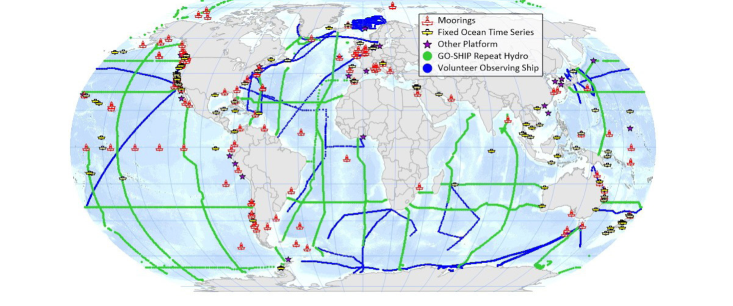
Present-day Global Ocean Acidification Observing Network, which is collaborative with Global Ocean Ship-based Hydrographic Investigations Program (GO-SHIP) surveys, the Surface Ocean CO2 Observing NETwork (SOCONET), the Ship of Opportunity Program (SOOP) volunteer observing ships and the Ocean Sustained Interdisciplinary Time-series Environment Observation System (Ocean-SITES), and other open ocean and coastal observing networks (after Tilbrook et al., 2019).


