The GCAN Region
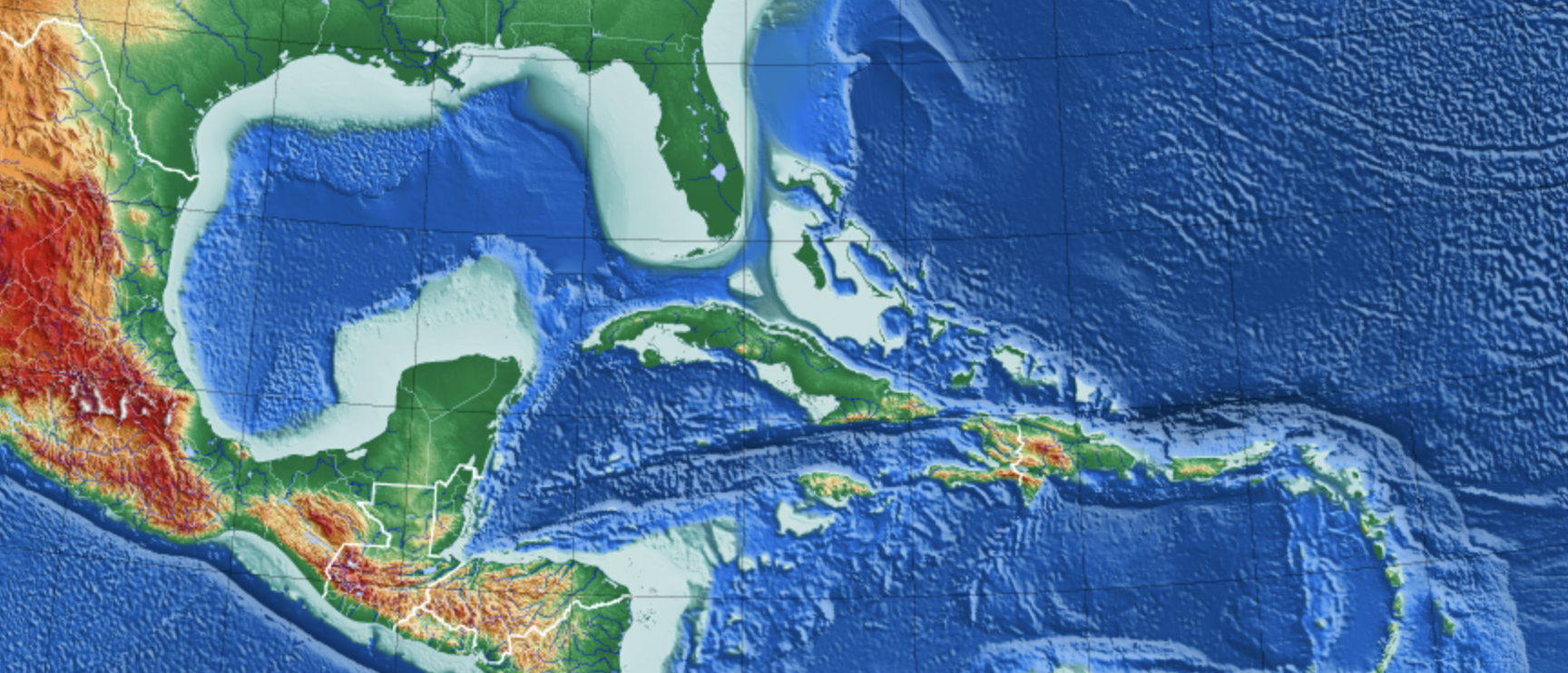
The Gulf of Mexico Coastal Acidification Network (GCAN) observing system focuses on the U.S. Gulf states — Texas, Alabama, Louisiana, Mississippi and Florida — and develops international partnerships and collaborations with Mexican and Cuban researchers focused on OA impacts and research.
Regional Stressors
The Gulf contains a wide range of ecosystems that provide important services and play a critical role in supporting the Gulf coast, United States, and international economies.
- U.S. commercial seafood landings revenue is $1.4 billion and accounts for 15% of the total national landings revenue. (NOAA Fisheries 2019 fig.)
- Shellfish contributed almost 73 percent of the revenue from all commercial landings in the Gulf (NOAA Fisheries 2019 fig.)
Gulf ecosystems are subject to multiple local and global human-induced stressors, including overfishing, eutrophication, hypoxia, oil spills, ocean warming and acidification. U.S. shellfisheries in the Gulf are particularly vulnerable to OA impacts because of a combination of environmental (e.g., eutrophication and high river input), biological (e.g., low diversity of shellfish fishery harvest) and social factors (e.g., low political engagement in OA and climate change and relatively low science accessibility; Ekstrom et al., 2015). Osborne, et al., 2022
- For a deeper dive into the state of ocean acidification and ecology in the Gulf of Mexico region, read “Ocean acidification in the Gulf of Mexico: Drivers, impacts, and unknowns,” Progress in Oceanography
- Citation: Emily Osborne, Xinping Hu, Emily R. Hall, Kimberly Yates, Jennifer Vreeland-Dawson, Katie Shamberger, Leticia Barbero, J. Martin Hernandez-Ayon, Fabian A. Gomez, Tacey Hicks, Yuan-Yuan Xu, Melissa R. McCutcheon, Michael Acquafredda, Cecilia Chapa-Balcorta, Orion Norzagaray, Denis Pierrot, Alain Munoz-Caravaca, Kerri L. Dobson, Nancy Williams, Nancy Rabalais, Padmanava Dash. Ocean acidification in the Gulf of Mexico: Drivers, impacts, and unknowns. Progress in Oceanography. Vol. 209. 2022. 102882. ISSN 0079-6611. https://doi.org/10.1016/j.pocean.2022.102882.
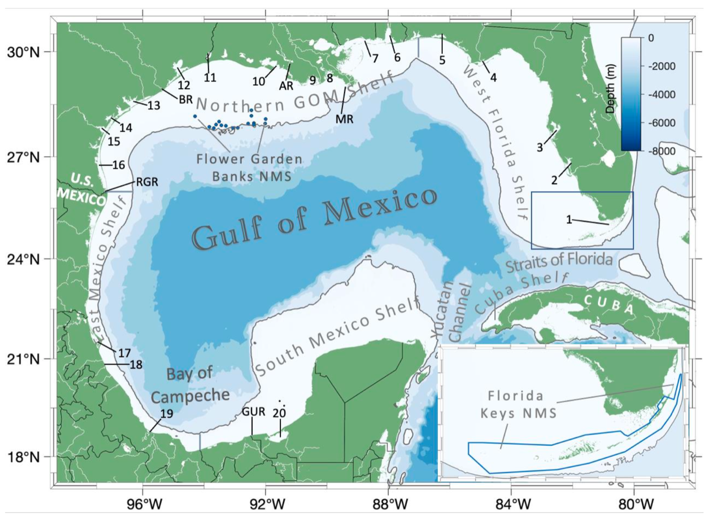
The map of the Gulf of Mexico to the right identifies major regions discussed in “Ocean acidification in the Gulf of Mexico: Drivers, impacts, and unknowns.” (Progress in Oceanography)
The solid gray line represents the 200 m isobath, defined as the boundary between the coastal continental shelf region and open GOM regions. The continental shelves are broken down geographically and described in detail within Section 2.2 of the paper above.

Selected major rivers, bays and estuaries are identified as follows: MR-Mississippi River, AR-Atchafalaya River, BR-Brazos River, RGR-Rio Grande River, GUR-Grijalva-Usumacinta River; Estuaries: 1-Florida Bay, 2-Charlotte Harbor, 3-Tampa Bay, 4-Apalachicola Bay, 5-Pensacola Bay, 6-Mobile Bay, 7-Mississippi Sound, 8-Barataria Bay, 9-Terrebonne/Timbalier Bays, 10-Atchafalaya/Vermilion Bays, 11-Sabine Lake, 12-Trinity-San Jacinto Estuary (Galveston Bay), 13-Colorado-Lavaca Estuary (Matagorda Bay), 14-Mission-Aransas Estuary, 15-Nueces Estuary (Corpus Christi Bay), 16-Laguna Madre (including both the upper and lower portions and Baffin Bay), 17-Laguna de Tamiahua, 18-Laguna de Tuxpan, 19-Laguna de Alvarado, 20-Laguna de Terminos.
The extents of the two U.S. national marine sanctuaries (NMS), Flower Garden Banks (dark blue dots) and Florida Keys (dark blue box and inset map), are also shown. Fig. 2 created using the MatLab package M_Map (Pawlowiz, 2020).
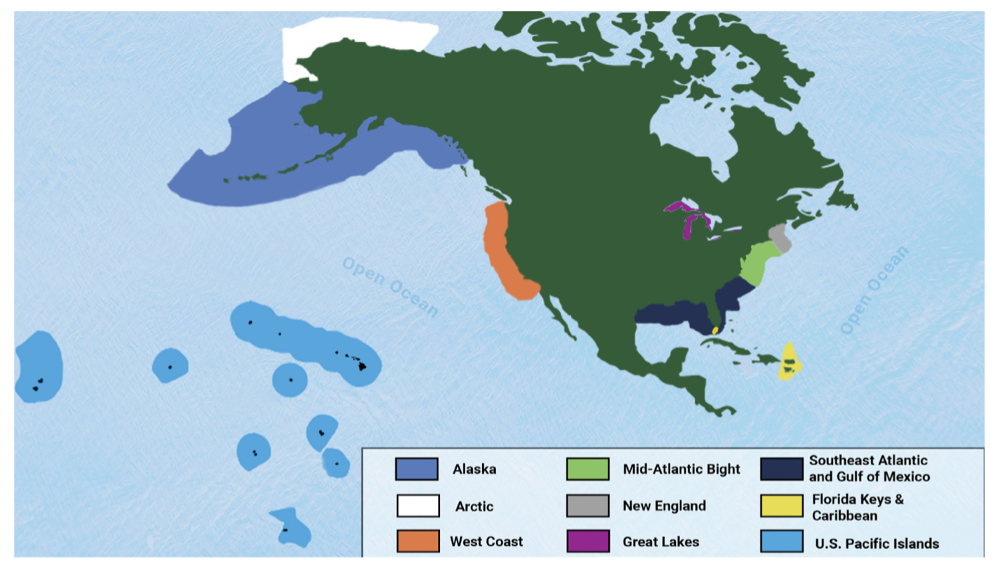
The map to the right outlines the eight U.S. coastal regions represented in the NOAA Ocean and Great Lakes Acidification Research Plan (Note: Southeast Atlantic and Gulf of Mexico form a single region). Coastal regions are closely based on the geographic extent of the Large Marine Ecosystem (LME’s), which represent areas of coastal oceans delineated on the basis of ecological characteristics that serve as suitable units to support ecosystem-based management.


