


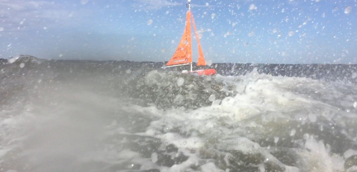
The GCOOS data portal used to track Gulf glider missions in real-time has proven so popular and easy-to-use by glider operators that we’re now tracking other autonomous ocean-going vehicles in other locales. We’ve tracked a  Navocean Nav2 Sail and Solar ASV being used to gather data in the Banana River Lagoon on Florida’s east coast.
Navocean and Turner Designs teamed up with FAU/HBOI researcher Dr. Jordon Beckler and 4Ocean to demonstrate mobile fluorometer data collection in support of new techniques to research red tide and other toxic algae blooms — including HABs in Lake Okeechobee — through the deployment of the Navocean “Nav2” vehicle, the first autonomous sail-driven surface vehicle to be used for inland algae monitoring.
The most recent three-day test on the Lagoon was intended to demonstrate data collection for the study of “brown tide” algae blooms that have been known for creating fish kills from severe hypoxic events, said Scott Duncan of Navocean.
The Navocean sailboat is equipped with a Turner Designs CI Fluorometer, which collected mobile data measurements through a strong storm event on the Lagoon despite driving rain and winds topping 50 mph. This type of disruptive weather event can stir up the bottom sediments and create large inflows of freshwater runoff into the lagoon. “Collecting mobile data through a storm of this nature is immensely exciting,” said Duncan, who also thanked Turner Design for donating the Fluorometer. “Seeing the sailboat tracks and all the data in near-real time on the GANDALF site is just so darn cool!”
We also made some recent upgrades to GANDALF, the server that hosts the glider portal:
- GANDALF is now mobile-friendly and fully responsive. (Dashboards and layers won’t appear on the mobile version.)
- The dashboard and layer controls are slightly different, and more intuitive.
- We’ve changed the default zoom to reflect the wider coverage area.
- We can now load data from local files or harvest from the IOOS NGDAC via ERDDAP
- There are no “moving streamlines” as this API is being removed by the provider. Instead, we’re loading the NRL velocity model at 30% opacity.
GCOOS has been assisting SECOORA by hosting their glider mission data since late summer 2018 and has tracked gliders off Florida’s east coast, including a mission to map the western edge of the Gulf Stream and how it interacts with the continental shelf.


