


About this product: Bathymetry
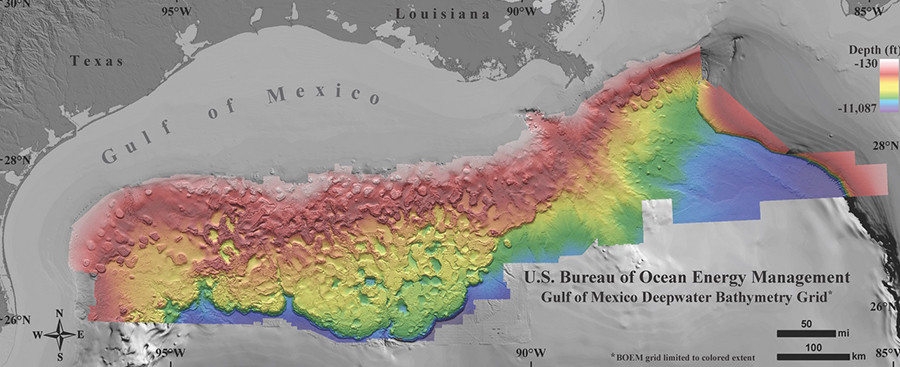
Bathymetry is the study of underwater depth and topography. This bathymetry data inventory contains various models and sources of bathymetric data currently available for the Gulf of Mexico.
Who is this product for?
This product is primarily used by scientists and researchers. It should not be used for navigation purposes.
Features
- Multiple sources of bathymetric data and models.
- Shoreline data and imagery available


