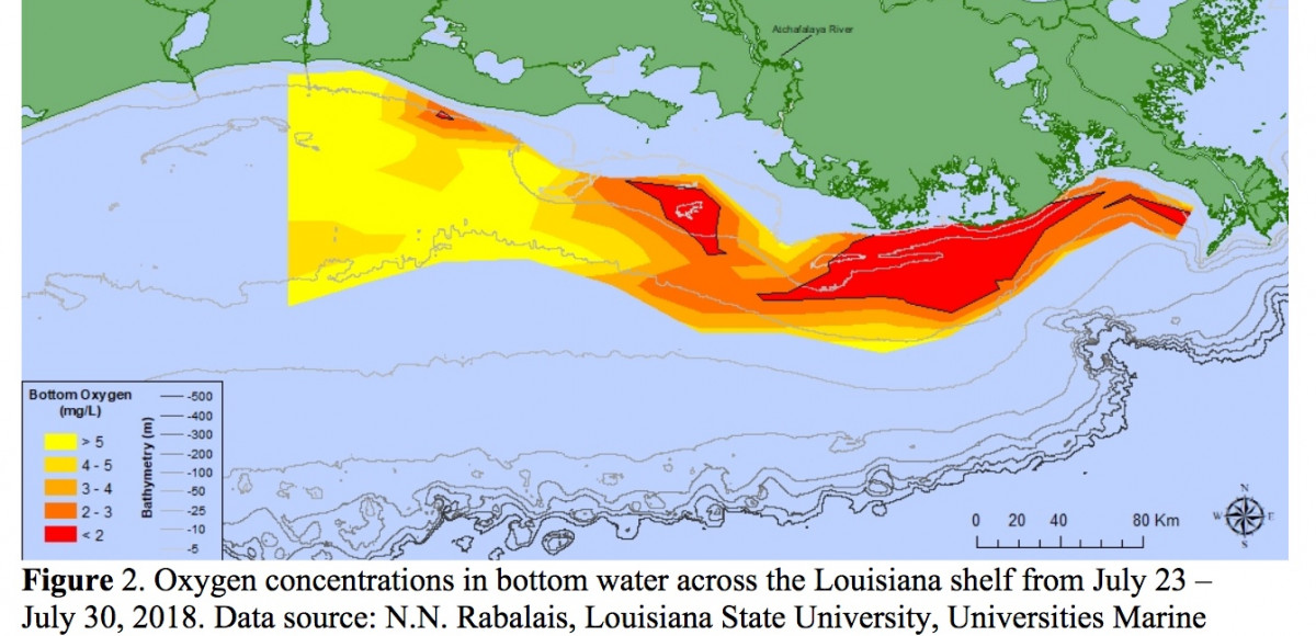
NOAA scientists are forecasting this summer’s Gulf of Mexico hypoxic zone or ‘dead zone’ — an area of low to no oxygen that can kill fish and other marine life — to be approximately 7,829 square miles or roughly the size of the land mass of Massachusetts.
This is the second year NOAA is producing its own independent forecast product, the culmination of a multi-year academic-federal partnership to develop a suite of NOAA-supported hypoxia forecast models. The partnership included teams of researchers at the:
- University of Michigan
- Louisiana State University
- William & Mary’s Virginia Institute of Marine Science
- North Carolina State University
- Dalhousie University
- USGS, which operates more than 3,000 real-time stream gauges, 50 real-time nitrate sensors, and 35 long-term monitoring sites throughout the Mississippi-Atchafalaya watershed.
The NOAA forecast integrates the results of these multiple independent models into a separate average forecast that is released in coordination with these external groups, some of which are also developing independent forecasts.
The LSU Forecast
The dead zone off the Louisiana coast is the second largest human-caused coastal hypoxic area in the global ocean. Researchers led by GCOOS Board Director Dr. Nancy Rabalais, Distinguished Research Professor at LUMCON and Professor and Shell Oil Endowed Chair at Louisiana State University, and Dr. R. Eugene Turner, Boyd Professor at Louisiana State University, consider various models based on the May nitrogen load of the Mississippi River as the main driving force to predict the size of this hypoxic zone in late July. The LSU prediction is based on one of these models.
Their June 2019 forecast is that the size of the hypoxic zone in the northern Gulf of Mexico for late July 2019 is that it will cover 22,557 square km (8,717 square mi) of the bottom of the continental shelf off Louisiana and Texas. The 95% confidence interval is that it will be between 20,433 and 24,821 square km (7,889 and 9,583 square mi).
This estimate is based on the assumption that there are no significant tropical storms in the two weeks before the next monitoring cruise, or during the cruise. If a storm does occur, then the size of the zone is predicted to be 70% of the predicted size without the storm, equivalent to 13,847 square km (5,346 square mi).
The predicted hypoxic area is about the size of the land area of New Hampshire — and 67% larger than an average year with no storms.
(The image above is from 2018.)


