GCOOS Governing Documents
Certification
GCOOS is one of 11 Regional Coastal Observing Systems (RCOS), which operate across the U.S. and have implemented specific data collection and management practices, including following a thorough vetting and documentation process. GCOOS was most recently recertified in 2023 by the U.S. Integrated Ocean Observing System (U.S. IOOS®) and the National Oceanic and Atmospheric Administration (NOAA). Recertification means that GCOOS continues to meet the gold standard for data gathering and management and operates inclusively, transparently and seeks user input to determine system priorities — and that GCOOS data holds the same quality assurance as data coming from federal agencies.
Guiding Documents
The GCOOS vision is to build a robust, user-driven, sustained, operational system that integrates physical, meteorological, biogeochemical, biological, bathymetric and other data from diverse providers, assures data consistency and quality and creates new data products needed by users. It also provides accurate data, products and services to IOOS, decision-makers and the public in a timely and efficient manner that benefits human communities and the economy, as well as natural ecosystems. These are the organization’s guiding documents:

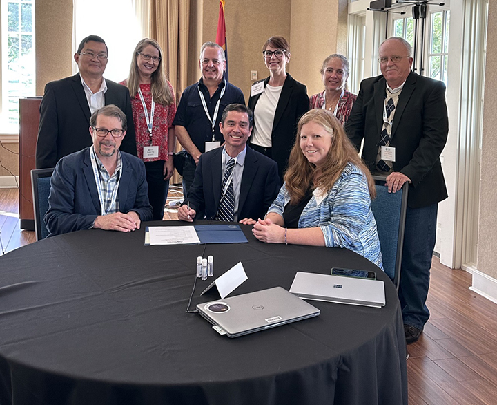
Recertification: Carl Gouldman, Director of U.S. the IOOS program office (seated, left); Dr. Jorge Brenner, GCOOS Executive Director (seated, center); and GCOOS Board Chair Kirsten Larsen (seated, right) sign the recertification memorandum of understanding in April 2023. Back row (L to R) GCOOS co-Data Manager and Systems Architect Felimon Gayanilo; Susan Fox, IOOS Regional Coordinator; GCOOS co-Data Manager and Product Developer Bob Currier; GCOOS Research Associate Jennifer Vreeland-Dawson; GCOOS Outreach & Education Manager Dr. Chris Simoniello; and GCOOS Board Member and Immediate Past Chair Joe Swaykos.
Data Management and Cyberinfrastructure
The GCOOS DMAC subsystem aggregates high-quality observed data and model output from providers and partners within our region. GCOOS then makes the resources and data-based products we and others develop widely available to diverse stakeholders for a variety of purposes by publishing them in uniform formats that make them easy to discover, access and use. GCOOS coordinates information gathered by partners running nearly 2,000 sensors in the Gulf’s coastal waters to the deep ocean. GCOOS Members help guide development of the Gulf’s observing system by providing input on the development of needed data products; voting in the Board of Directors elections and participating in GCOOS councils, committees and task teams.


