Forecasters are calling for an extremely active hurricane season this year and glider operators in the Gulf are getting ready.
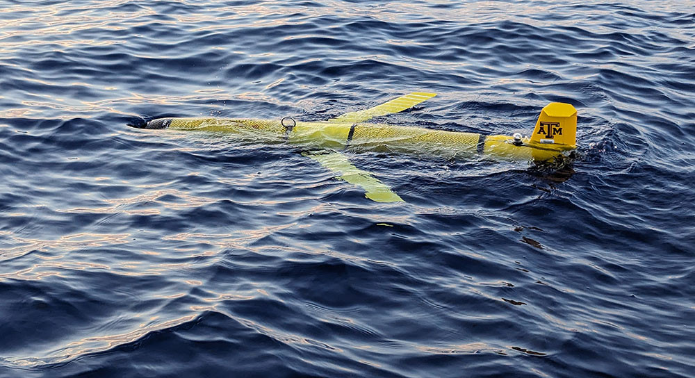
In May 2024, researchers with Texas A&M University’s Geochemical and Environmental Research Group (TAMU-GERG) prepared to launch two gliders in the Northwestern Gulf, says Dr. Uchenna Nwankwo, GCOOS Oceanographer and Assistant Research Scientist with TAMU-GERG, who helps to coordinate mission planning for all Gulf gliders.
In all, operators from TAMU-GERG, the University of Southern Mississippi (USM), the University of South Florida (USF) and Sarasota, Florida-based Mote Marine Laboratory (MML) are planning for at least 20 glider missions. The U.S. Navy is also taking part by providing four gliders for launch by GERG, USM and USF, and NOAA’s Atlantic Oceanographic and Meteorological Laboratory (AOML) will be deploying a Saildrone as well. “This year, we want to have some gliders in the Gulf early in the season so we can capture prevailing conditions before the most intense part of hurricane season,” Nwankwo said. “The bulk of the launches this year will take place in June and August. Ultimately, we want to have the entire northern Gulf covered.”
Uncrewed systems, which can operate even during dangerous conditions, gather and transmit critical ocean temperature and salinity data in near-real-time that can be used immediately by hurricane modelers to help predict how and where storms will develop and how intense they could become. These factors are critically important for protecting lives in the face of destructive hurricane-force winds and storm surge.
The intensity of hurricanes is influenced by many factors — atmospheric circulation, internal storm dynamics, air-sea interactions, boundary currents — but ocean heat content is perhaps the most critical factor driving storm intensification. Surface layer temperatures and salinity levels are key factors driving ocean heat content, with the vertical gradient in salinity and temperature driving the surface layer heat content, influencing storm conditions. Since they operate throughout the water column to about 1000 meters and sometimes in shallower depths, gliders are especially crucial in gathering this data.
During hurricane season, you can follow glider missions on GCOOS’s glider piloting dashboard GANDALF which provides real-time vehicle positioning information via a maps-based interface with a dashboard display, plots of flight and science sensors, NOAA model comparisons, Google Earth KMZ file generation and access to processed data files. GANDALF is equipped with numerous layers that can be individually displayed on the base map. Each layer’s transparency can be individually adjusted allowing for multiple layer overlays.
Current Forecasts
- NOAA will issue its outlook for the 2024 Atlantic hurricane season during a news conference on Thursday, May 23, at the National Press Club in Washington, D.C., and virtually.
- Colorado State University researchers have released their early predictions for the 2024 Hurricane Season in the Atlantic Basin. The forecast calls for an “extremely active” season with 23 named storms, including 11 hurricanes. Five of the storms are predicted to be major category 3, 4 or 5 hurricanes. CSU will issue updates on June 11, July 9 and Aug. 6.
- AccuWeather meteorologists are forecasting 20-25 named storms across the Atlantic basin, including 8-12 hurricanes, four to seven major hurricanes and four to six direct U.S. impacts.


